A Brief History of "The Firelands"
In the years after the American Revolution, the state of Connecticut owned land called the Connecticut Western Reserve in the northeast corner of the Northwest Territory. This area bordered Lake Erie in what is now northeast Ohio. This area had two parts, and the western part became known as the “Fire-Lands.”
During the Revolutionary War, British soldiers burned nine towns in Connecticut: Danbury, East Haven, Fairfield, Greenwich, Groton, New Haven, New London, Norwalk, and Ridgefield, and the affected citizens sought restitution from the Connecticut legislature.
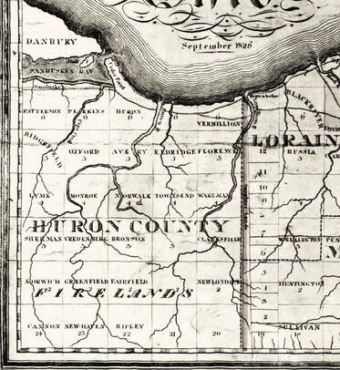
In 1792, the Connecticut legislature set aside the 500,000 western most acres of the Western Reserve for its citizens whose land had been burned by the British. This area was referred to as the Fire Suffers’ Lands, which was shortened to the “Fire-Lands” and later to the “Firelands,” all of which became Huron County. Permanent settlement of the area began about 1808, but most of the settlement did not occur until after the War of 1812.
Ohio became a state in 1803, and the entire “Fire Lands” area was named Huron County in 1809. Today Huron County is composed of nineteen of the original Firelands townships. In 1838, Erie County was formed from nine northern townships of the Firelands, and later Danbury was transferred from Erie County to Ottawa County (1840) and Ruggles from Huron County to Ashland County (1846).
See Also on This Website:
Huron County History
Erie County History
During the Revolutionary War, British soldiers burned nine towns in Connecticut: Danbury, East Haven, Fairfield, Greenwich, Groton, New Haven, New London, Norwalk, and Ridgefield, and the affected citizens sought restitution from the Connecticut legislature.
In 1792, the Connecticut legislature set aside the 500,000 western most acres of the Western Reserve for its citizens whose land had been burned by the British. This area was referred to as the Fire Suffers’ Lands, which was shortened to the “Fire-Lands” and later to the “Firelands,” all of which became Huron County. Permanent settlement of the area began about 1808, but most of the settlement did not occur until after the War of 1812.
Ohio became a state in 1803, and the entire “Fire Lands” area was named Huron County in 1809. Today Huron County is composed of nineteen of the original Firelands townships. In 1838, Erie County was formed from nine northern townships of the Firelands, and later Danbury was transferred from Erie County to Ottawa County (1840) and Ruggles from Huron County to Ashland County (1846).
See Also on This Website:
Huron County History
Erie County History
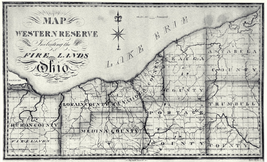
1826 Map of the Western Reserve Including the Firelands
"The Fire Lands" in the Western Reserve
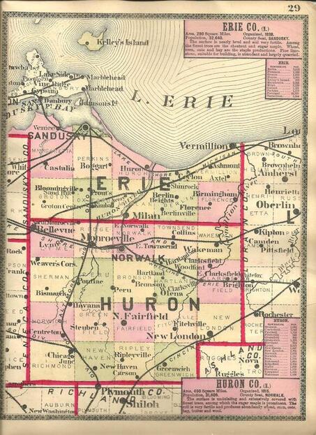
From: Bridgman's Atlas of the State of Ohio, E. C. Bridgman, New York, ©1888, p. 29

Sources:
“Firelands” from Wikipedia “History of the Firelands” – Firelands Chapter of the DAR, Vermilion, Ohio “Sufferers’ Land” – Firelands History Website “Firelands Facts” and “Learn of the Firelands of the Western Reserve of Ohio”
“Firelands” from Wikipedia “History of the Firelands” – Firelands Chapter of the DAR, Vermilion, Ohio “Sufferers’ Land” – Firelands History Website “Firelands Facts” and “Learn of the Firelands of the Western Reserve of Ohio”
- Pamphlets published by the Firelands Council of Historical Societies, available at the Laning-Young Research Library.